Stonex XFLY120-Home-Shop.motmould-3DPrinters Store-Motmould
search

Stonex XFLY120

€43,010.92
Tax included

Stonex XFLY120 – Advanced LiDAR Solution for DJI M350

·       Drone LiDAR Technology: 

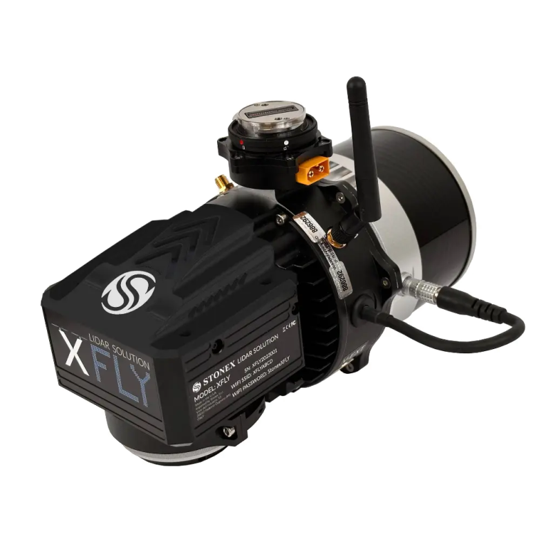
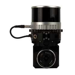
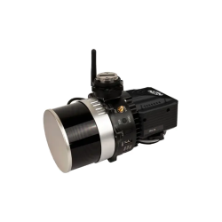
High-precision LiDAR system designed for seamless integration with DJI M350 drones.

·       Extended Range: 

Offers a maximum range of 300 meters, capturing detailed point cloud data from greater distances.

·       Efficient Flight Time:

Optimized for up to 35 minutes of flight, ensuring extended aerial data collection.

·     Lightweight & Low Power:

Compact design enables longer flights while adapting to various project requirements.

·       FLYpost App Included:

Comes with free FLYpost software for easy post-processing and enhanced data accuracy.

Quantity

Contact us
Stonex XFLY120

Stonex XFLY120

I accept privacy policy rules  

Stonex XFLY120

Advanced LiDAR Solution for DJI M350

FLYpost software

The software observes and corrects misalignments between the INS and LiDAR, and georeferences the data into a geographic coordinate system. The post-processed INS trajectory, LiDAR scan files and camera images are converted to colored point clouds in LAS format for further processing. 

PHYSICAL SPECIFICATION

Weight1,6 kg (without battery)
Size372 mm x 163 mm x 106 mm
Operating temperature-10°C to +45°C (14°F to 113°F)
Operating humidity<85% RH
Waterproof/DustproofIP54

CAMERA

ModelADTi 24MP RGB
LensSony E-Mount 16mm, 70° FOV
Max Trigger Rate2 seconds

RGB CAMERA

ConstellationsGPS, GLONASS, BEIDOU, GALILEO
Output Rates

Up to 200HZ (INS)

Up to 2000HZ (IMU)

Pitch/Roll Accuracy

0.03 (RTK) 2

0.006 (PPK)

Heading Accuracy

0.15 (RTK) 2,3

0.03 (PPK)

Velocity Accuracy<0.03 m/s
Position Accuracy

1cm+1ppm (RTK)

0.5cm (PPK)

LIDAR

Sensor*Hesai XT-32
Range

0.5 - 120m

80m @10% (c9-24)

50m @10% (c1-8; 25-32)

Range Accuracy±1cm
FOV (Horizontal)360°
FOV (Vertical)31°
Scan Angle (Vertical)-16° to 15°
Beam Divergence0.04° (H), 0.098° (V) 1
Channels32
Returns2
Pulse rate

640k/s (single return)

1280k/s (dual return)

SYSTEM

System Vertical Accuracy (5m/s @50m)±3cm
Recommended AGL50-80m
Weight

1.7kg (with camera)

1.3kg (no camera)

Dimensions20.8 x 14.2 x 17 cm
Max Flight Time (DJI M300)33 Minutes
External Storage256GB USB Included
10 Items
Comments (0)
No customer reviews for the moment.